Name of Hike: Castle Rock
Trail(s): Castle Rock Trail
Location: Big Bear Lake, CA
Wilderness Area: San Bernardino National Forest
Type of Hike: Out-and-back
Difficulty: Moderate
Distance/elevation: 1.4 miles, 423 ft elevation gain
Estimated Time Commitment: Hiking times can vary for a number of reasons, but we estimate most people would be able to complete this hike in 1-2 hours.
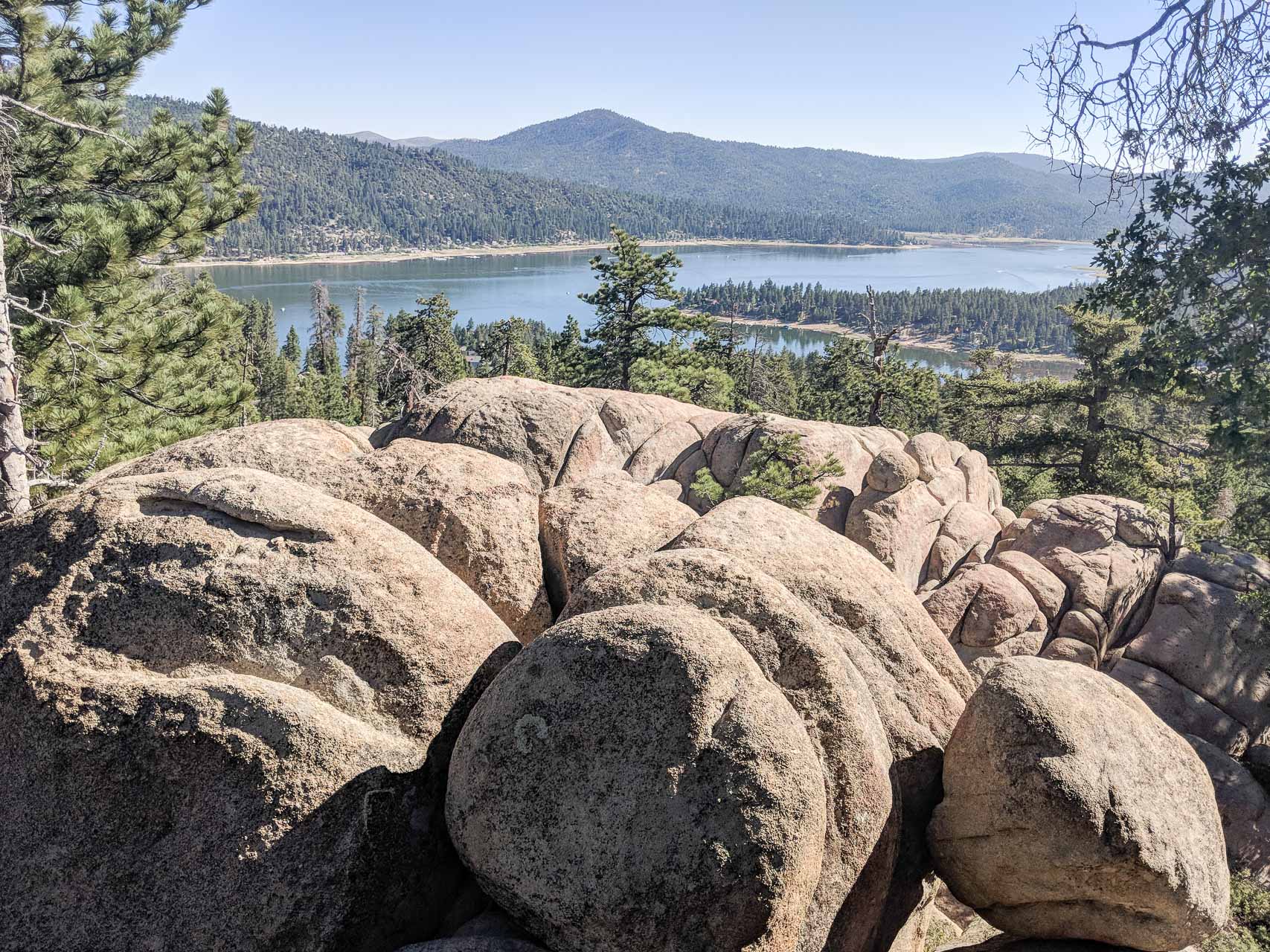
Views: Yes, there are some great views from Castle Rock looking over Big Bear Lake.
Popularity: The Castle Rock Trail is exceptionally popular (especially during the summer months), and you can expect to encounter many other hikers and potentially hikers with furry friends.
Facilities/restrooms: None
Directions: The Castle Rock Trailhead is located 1.1 miles east of Big Bear Lake Dam on the north side of CA-18. It is right next to the city limit sign for Big Bear Lake.
Parking: There is parking scattered along both the left and right shoulders of CA-18 near the trailhead. The largest section to park nearest the trailhead can accommodate about 10 cars.


The Castle Rock Trail is located in the San Bernardino National Forest and is open to hikers and dogs. More detailed and up-to-date information on the San Bernardino National Forest available here.
The trail begins directly off the CA-18 at the city limit of Big Bear Lake. Be careful when walking along the road (or crossing) to get to the trailhead. The road is winding and generally busy with traffic cruising at 40+ mph.
The Castle Rock Trail is well traveled and well marked (with trail signs and light-blue spray paint). It is a single track for the majority of the hike, but occasionally widens out so that two people can comfortably walk side-by-side.

This hike climbs steeply for the first half mile and then transitions to a more gradual climb for the remaining distance to Castle Rock. There are lots of roots and rocks on the trail, so mind your step!


The climb to Castle Rock is a short distance, but it definitely gets your heart pumping! There are a few places to stop along the way, but none quite as comfortable and well placed as these benches.

We arrived at a spot in the trail where the blue trail markers seemed to deviate from the more popularly traveled route. Because of this hike’s tremendous popularity, though, we were able to ask a group of hikers on their decent about which route to take. They let us know that, essentially, all routes lead to the Rock. We elected to follow the markers and successfully arrived at the sign for Castle Rock.

You are not immediately rewarded with views since you’re hiking through a forest of pine trees and boulders, but the view from the top does not disappoint. There is also a great view of the Castle Rock formation from the trail before the final climb.

People braver than I am scale the rocks to see the view from the top. Conner is one of those people and he reported having a relatively unobstructed view of the lake and surrounding area from the top. It is also a very popular rock climbing location. If you’re lucky there will be some scaling the various routes while you’re there – be prepared to be impressed!


After exploring the rock formation for a time, we began our descent back to the car. We followed some of the frequented side-trails around the rocks to get back to the main trail.
This trail is very popular. We hiked it on a Sunday morning and encountered many groups, families, individuals, couples, dogs, you name it! It was a little quieter on the way up, but our descent was at around 9:00 AM when activity was ramping up. Everyone was very friendly, and we enjoyed seeing so many people enjoying the great outdoors!
If you’re looking to avoid the crowds, your best bet is to go early in the morning or late in the evening. You can also try a weekday when school is in session.
This is a short out-and-back trail – our total distance was 1.4 miles. If you’re feeling up for a longer hike, this trail continues beyond Castle Rock to Forest Service road 2N86 and connects to other trails from there. Lots of possibilities!

Thanks for reading our review of The Castle Rock Trail! Please check out our video trail review of Castle Rock on YouTube.