Name of Hike: Orange Grove Trail to the Upper River Loop Trails
Trail(s): Orange Grove Trail, Wills Crossover, Upper River Loop Trails
Location: Meiner’s Oaks, CA
Wilderness Area: Ventura River Preserve
Type of Hike: Loop
Difficulty: Easy
Distance/elevation: 2.5 miles, 113 ft elevation gain
Estimated Time Commitment: Hiking times can vary for a number of reasons, but we estimate most people would be able to complete this hike in 1-2 hours.
Views: Yes, there are some nice views looking towards the Topatopa Mountains. Since the elevation gain on this particular hike is negligible, the views are from down low and not panoramic.
Popularity: The Ventura River Preserve is very popular, and you can expect to encounter many other hikers, bikers and equestrians.
Facilities/restrooms: None
Directions: The Ventura River Preserve can be accessed by a few different trailheads. For the hike we did, the Orange Grove Trail to the Upper River Loop Trails, we used the Oso Trailhead. If you are approaching from the east, head west on the 150 through the town of Ojai. Take a right on the 33 North. In 1.6 miles, turn left on Fairview Road. At the T-stop, turn right on Rice Avenue, then left on Meyer Road. If you are approaching from the west, take the 33 North towards Ojai. Take a left at the intersection just before downtown Ojai to stay on the 33 North, then proceed according to the directions listed above. The trailhead can be found at the end of Meyer Road through a white metal gate (pictured below). The gate hours are 8:00AM – 7:30PM between April 1 and October 31.
Parking: There is a good-sized dirt parking lot at the Oso Trailhead. However, given the popularity of this location, spaces can fill up quickly.

There are so many great hiking options in the Ventura River Preserve. We went intending to hike the Rice Canyon – Wills Canyon Loop, but saw for ourselves that the route was impassable. Unfortunately, this area was significantly impacted by the Thomas Fire in December 2016 and the bridge across the canal used to access the Rice Canyon Trail burned. We had read on another forum that the trail was still accessible if you weren’t afraid to bushwhack a bit and crawl under some barbed wire. Once we arrived at that spot, however, we quickly realized that it was not a hike we should be recommending to our constituents at this time. We do look forward to returning and exploring more of trails in the preserve soon. For up-to-date information on the Ventura River Preserve, trail conditions and map check out their website here.
The Ventura River Preserve is open to hikers, bikers, equestrians and dogs.

We started our hike at the Oso Trailhead. There are two different trails that originate at this point – the Orange Grove Trail and the Upper River Loop Trail. We headed west on the Orange Grove Trail and went to investigate the situation with the burnt out bridge on the Rice Canyon Trail. Not long after setting out from the parking lot (probably around 0.1 a mile) you’ll cross the Ventura River. We were pleasantly surprised to find so much water! There are rocks strewn through the river making it reasonably easy to cross, but do be careful to make sure the stepping stones are secure before putting all of your weight on them.

We continued along the Orange Grove Trail a short way further and came to an intersection with the Rice Canyon Trail. We branched right on the Rice Canyon Trail and after confirming that trail’s (hopefully only temporary) closure, we changed our plan and went to explore the lower trails close to the river.

The sign pictured above is a little confusing, because the left direction actually continues along the Orange Grove Trail towards the Wills Canyon Trail. Despite having a map and trails being reasonably well-marked, we did manage to get a little lost later on because of slight deviations like that…
The Orange Grove Trail is very wide and flat. It travels on an elevated bank parallel to the river. We went on a weekend, so we crossed paths with other people every few minutes on this trail.

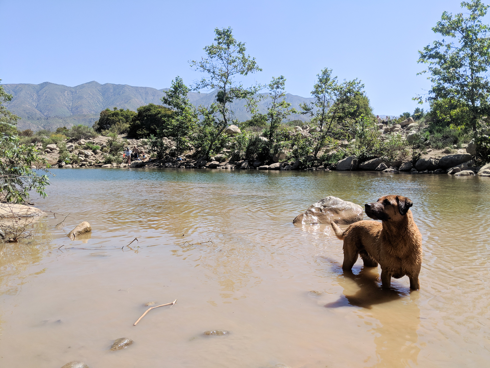
About a half mile along this trail we saw a large swimming hole in the river. There were a number of small trails on the lefthand side of our trail that led down to the swimming hole – you can take your pick! The only difference between them all is where along the swimming hole you end up. There was already a group of people set up on the beachy side, so we opted for a spot a little further down. Bean loves to swim, so we took a short break here to indulge her.

We followed the Orange Grove Trail to what we thought was the end, however we did not look closely enough at our map (see below). We should have connected with the Wills Canyon Crossover Trail for a brief stretch, but instead continued straight to a dead end at a chain link fence. Fortunately, because we had the map of the preserve with us, we had a good sense of where we would meet up with our next trail. We bushwhacked along and across the river for a short way until we met up with one of the branches of the Upper River Loop Trails.

As can be seen from the above map, there is a network of short trails that comprise the “Upper River Loop Trails.” There are even more little side trails than are indicated on the map. We picked a more direct route back to the parking lot since the day was beginning to get hot, but we could have easily spent a little more time meandering and exploring along the river bank.

Much like the Orange Grove Trail, the Upper River Loop Trails are easy going. They are nice and wide (you could fit four or more people abreast easily in spots!) and there is virtually no elevation change. This particular loop would be a great excursion for people of all ages and experiences.
We look forward to going back to the Ventura River Preserve soon and exploring more of its lovely trails.
Thanks for reading our review of The Orange Grove Trail and the Upper River Loop Trails in the Ventura River Preserve! Please check out our video trail review of The Ventura River Preserve on YouTube.