Name of Hike: Grand Canyon South Rim Trail
Trail(s): South Rim Trail
Location: Grand Canyon, Tusayan, AZ
Wilderness Area: Grand Canyon National Park
Type of Hike: Out-and-back or one way (facilitated by shuttle buses)
Difficulty: Easy
Distance: 12.8 miles one way
Estimated Time Commitment: Hiking times can vary for a number of reasons, including but not limited to hiking distance, shuttle times and photo stops. The section we hiked from Bright Angel Trailhead to Mohave Point (out and back) took around 4.5 hours.
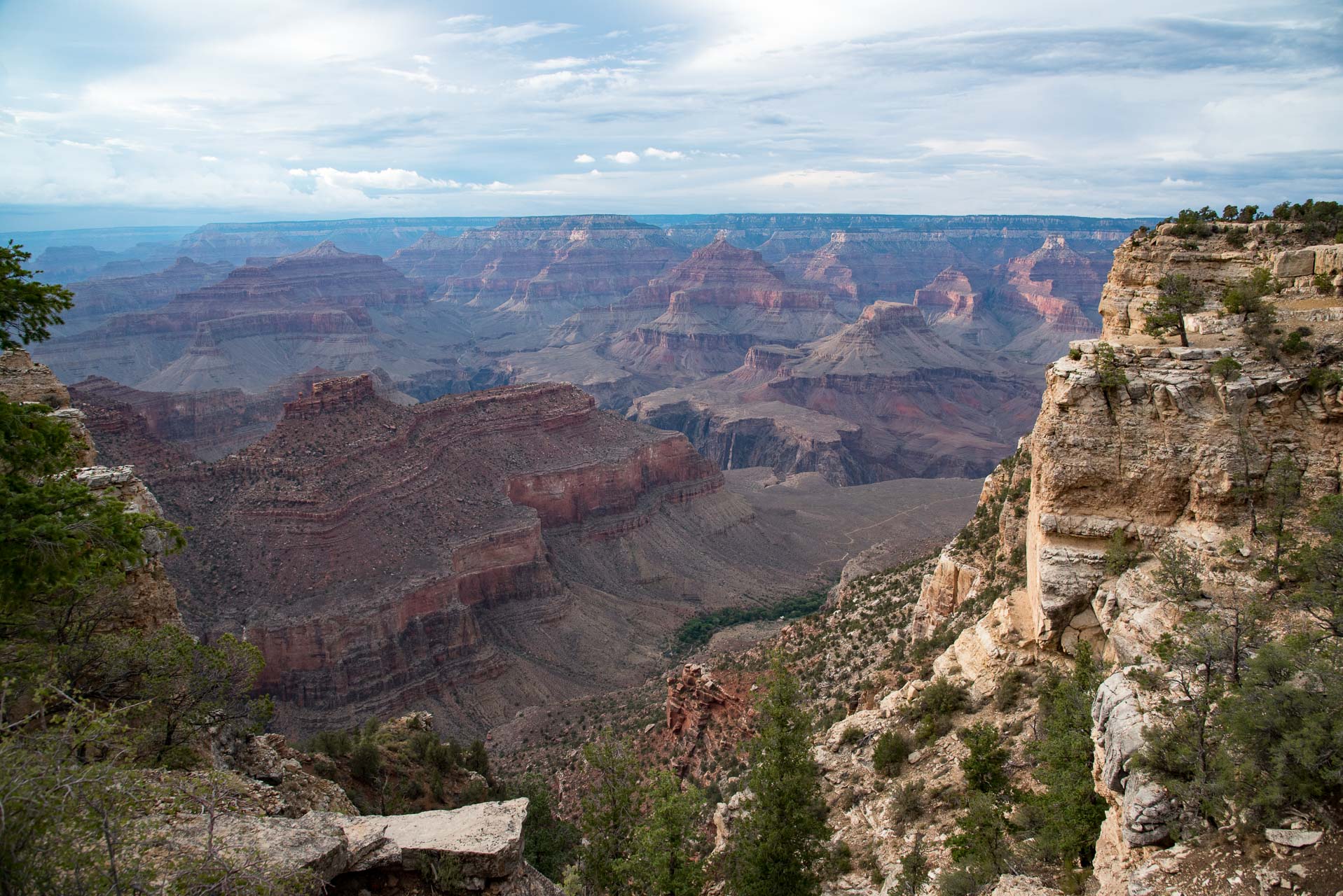
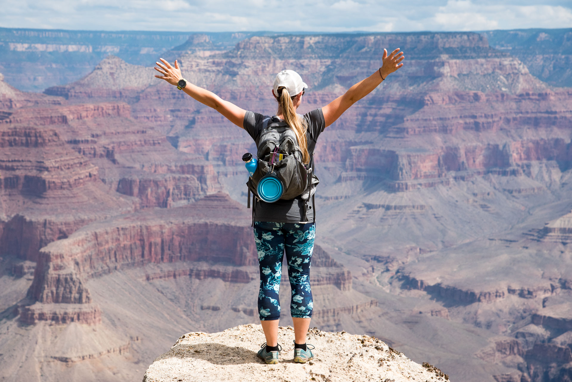
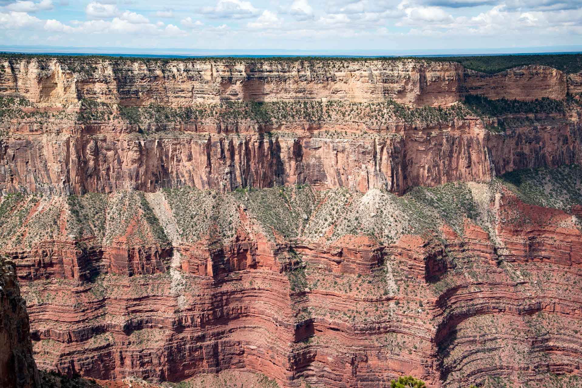
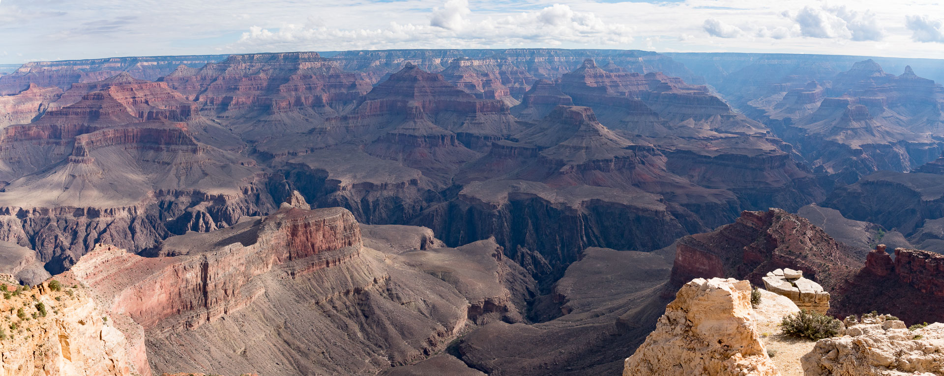
Views: There are unbeatable views along the entire length of the South Rim Trail.
Popularity: The South Rim Trail at the Grand Canyon is exceptionally popular (especially during the summer months), and you can expect to encounter many other people. Though dogs are allowed on leash, we did not encounter many.
Facilities/restrooms: There are many restrooms along the route at the various shuttle stops. They will range from nicely maintained pit toilets to full blown restrooms with sinks/mirrors/running water (luxury!).
Directions: Drive to Williams, AZ (from wherever you are!). From Williams, drive north on AZ-64 for approximately 55 miles. Before you reach Grand Canyon Village, you’ll need to pay the fee to enter the park. The official website for the Grand Canyon National Park has all the information you could possibly need on directions, fees, lodging, activities, weather and traffic alerts, etc. If your first stop is the visitor’s center, stay straight on the South Entrance Road. The road will curve around to the left and the visitor’s center will be on the right. That’s as good a place to start as any!
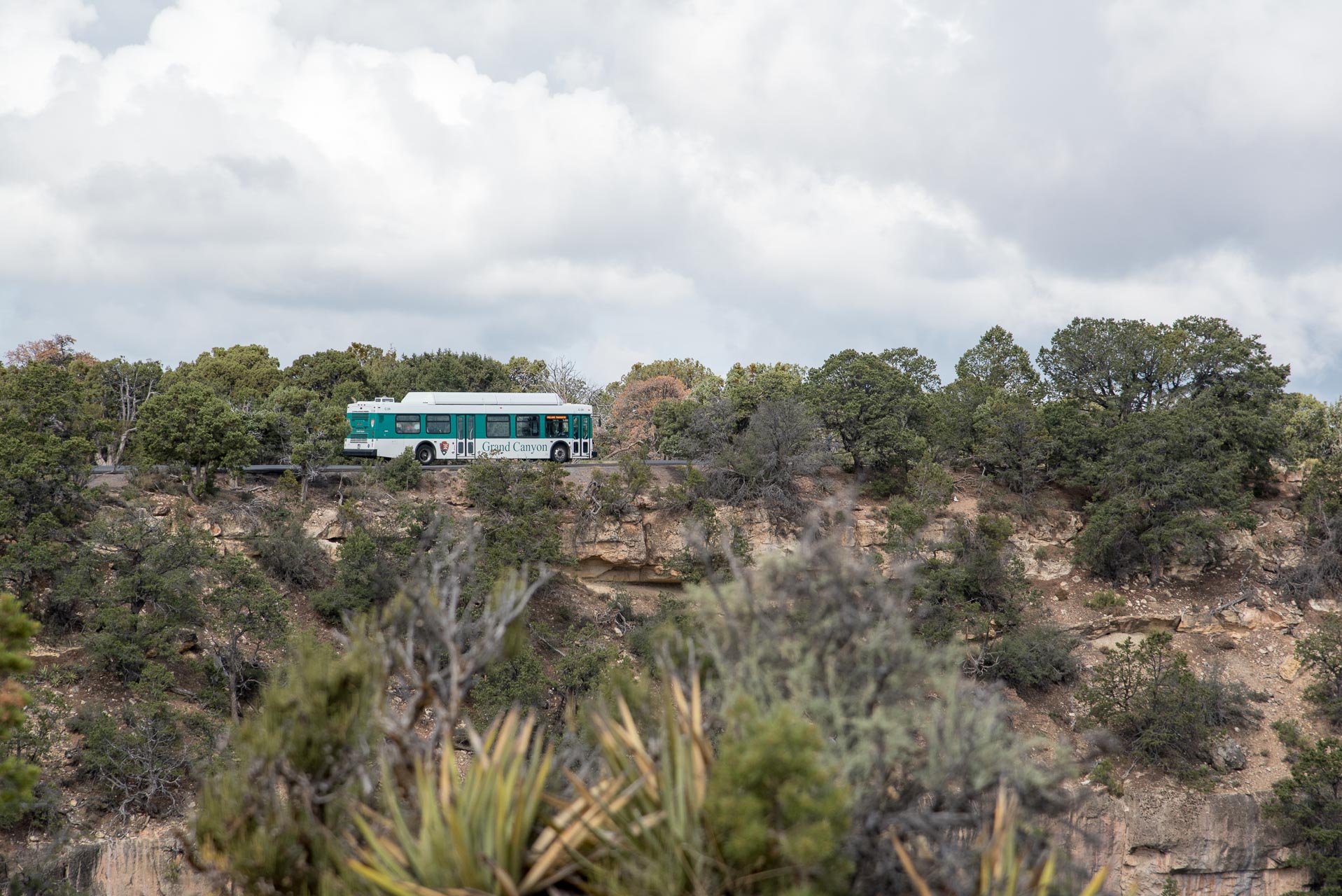
Parking: There is ample parking at the South Rim of the Grand Canyon, though it is limited at each specific spot. The FREE! shuttle buses make it easy to park anywhere within the park and still easily access all points on the South Rim Trail. If you are traveling with a furry friend, be aware that dogs are unfortunately not allowed on the shuttle buses.
Since we had Bean with us, needed to park at the Bright Angel Lodge to access the section of the South Rim Trail that we wanted to hike. Parking here accommodates roughly 50 cars – which sounds like a lot, but it’s not nearly enough. We lucked out in finding a spot even though we arrived relatively early in the morning for our hike.


We started our section hike of the South Rim Trail at the Bright Angel Trailhead and hiked west towards Hermits Rest.
The incredible views start immediately and they never go away! We stopped often to take pictures and soak in the grandeur of this natural wonder.

Not far along the trail, you start gaining elevation. The elevation change is not significant, but most of the elevation change on this section hike (486 feet gain) occurs between the trailhead and the Trailview Overlook. The trail switchbacks for less than a half a mile and then all elevation change is very gradual.

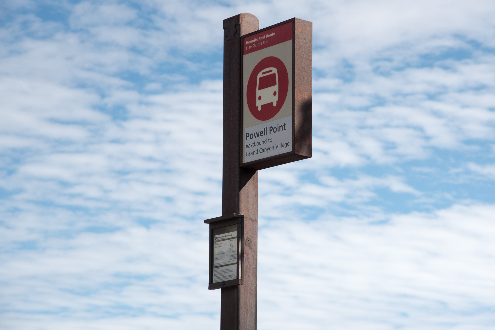
This section of the trail is not quite as popular as the sections closer to the two visitor’s centers – The Grand Canyon Visitor’s Center and Verkamp’s Visitor’s Center. No private vehicles are allowed on the road to Hermits Rest from March 1 through November 30, so most people experience this section of the South Rim from the shuttle buses.
The majority of the South Rim trail is on a wide paved path where more than four people can comfortably walk abreast. West of the Bright Angel Trailhead, the section that we hiked, the path narrows to a path only wide enough for two people. While the majority of the path is paved, there are sections west of Powell Point that are well packed dirt/rock. The entire length of the trail is very well maintained – there were crews cleaning and making improvements along the trail the day we hiked.

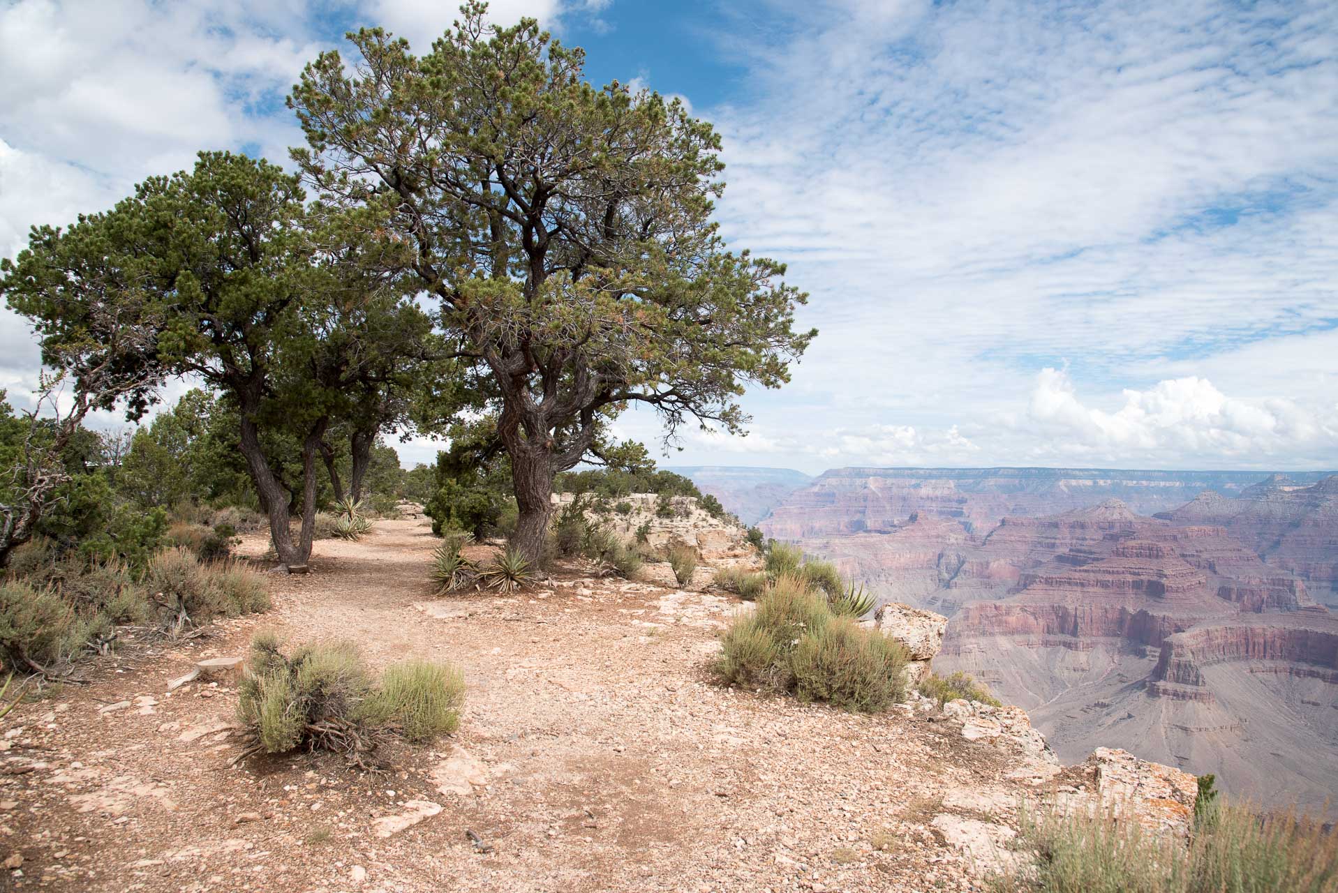
There are no guide rails along the trail until you get the various viewpoints. There are places where the trail gets close to the edge of the canyon, so be careful along those stretches!

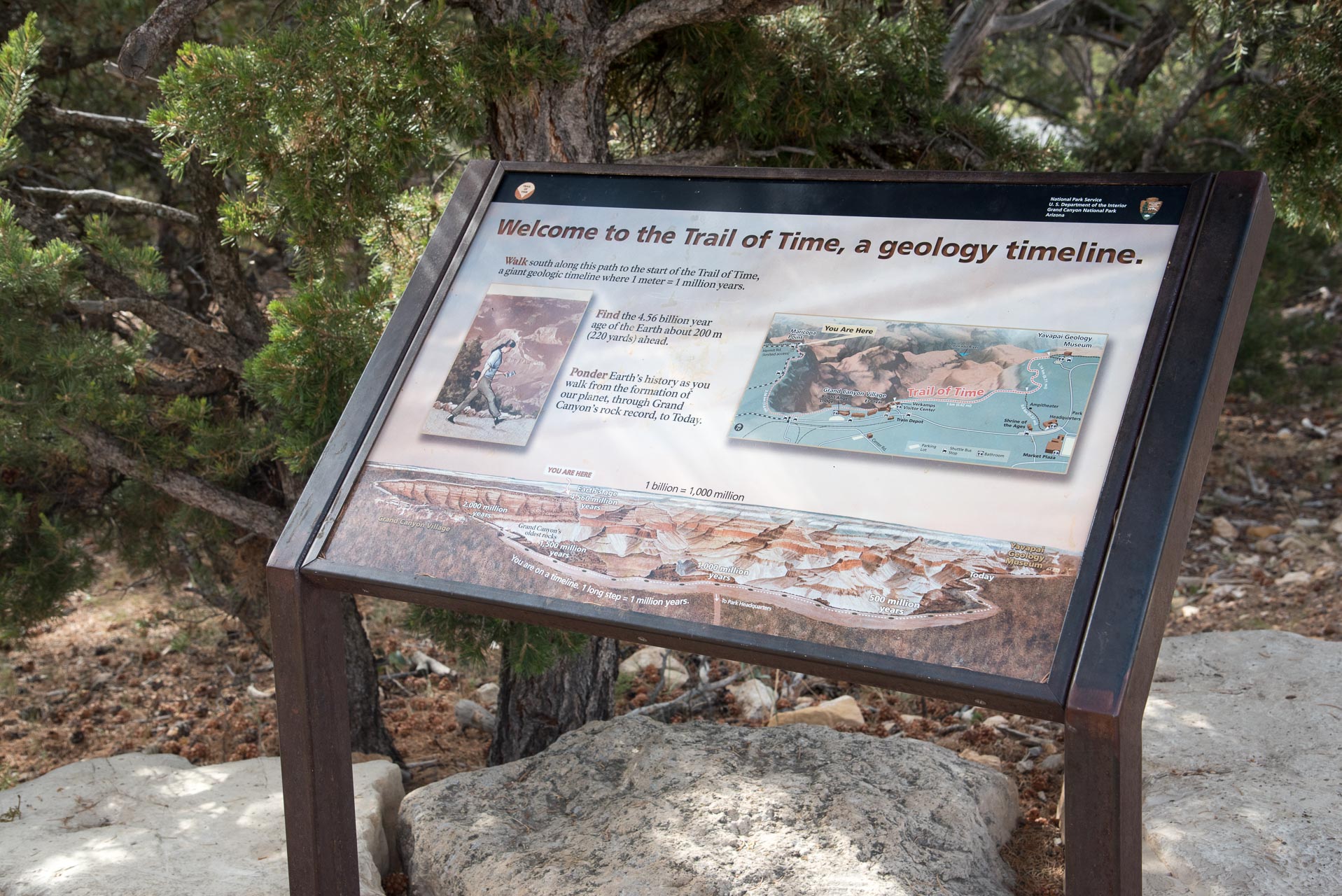
The trail is well marked with signs and the various shuttle stops make it easy to determine exactly how far you’ve gone. Along a significant length of the South Rim Trail runs the “Trail of Time.” The Trail of Time educates the public on geologic features of this natural wonder. Each meter you travel represents one million years since Earth’s origin.
Something to keep in mind is that the average elevation of the South Rim of the Grand Canyon is around 7,000 ft. If you are not accustomed to elevation, make sure to take frequent breaks and drink lots of water. There are water stations along the more populated sections of the Rim Trail (near the visitor’s centers), but as you get “further out” towards Hermits Rest there are no refill stations.
We would definitely rate this hike as easy and can confidently recommend it to people of all ages and physical abilities – just be mindful of the possible effects of altitude and the steep drop offs.
We highly encourage you to make the trip to see the Grand Canyon. Pictures (mine especially) do not do it justice! It will be an experience you never forget.
Thanks for reading our review of The South Rim Trail! Please check out our video trail review of The South Rim Trail on YouTube.