Name of Hike: The Pines
Trail(s): Horn Canyon
Location: Ojai, CA
Wilderness Area: Los Padres National Forest
Type of Hike: Out-and-back
Difficulty: Moderate
Distance/elevation: 5 miles, 1,655 ft elevation gain
Estimated Time Commitment: Hiking times can vary for a number of reasons, but we estimate most people would be able to complete this hike in 2-3 hours.
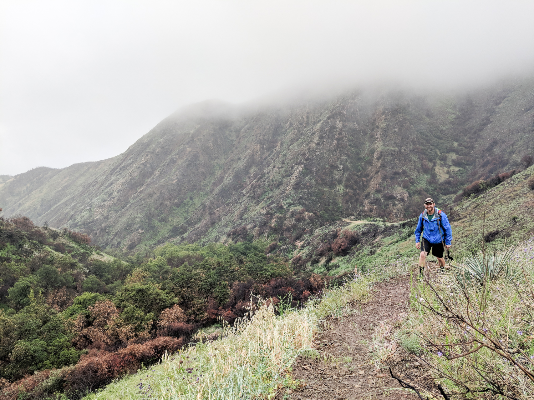
Views: Yes, there are some nice views looking down Horn Canyon back towards the Ojai Valley once you start gaining more significant elevation. You will not reach a summit on this hike, though, so there will not be any panoramic views.
Popularity: The Horn Canyon Trail is reasonably popular. It is not so popular that you are encountering other humans constantly, but it is entirely possible to share the trail with other hikers, equestrians and mountain bikers.
Facilities/restrooms: None
Directions: This hike starts at the Horn Canyon Trailhead in Ojai, CA. If you’re approaching Ojai from the west – head east through town on the 150, take a left on Reeves Rd (immediately before Boccali’s restaurant – great food if you’re looking for a post-hike meal, we especially recommend their seasonal strawberry shortcake!), take another left on McAndrew Rd (follow all the way to the top of the hill), then take a right into The Thacher School campus (if the gate is closed there is some space to park along the street and then you’ll walk the rest of the way to the trailhead), take another right around the perimeter road of the campus, then take one last right on the dirt road and the Horn Canyon Trailhead will be on your left. Keep in mind that you are driving through private property to get to the trailhead, so please remember to drive slowly and be courteous. If you’re approaching this hike from the east you won’t actually reach the town of Ojai before the turnoff for Reeves Rd. Follow the 150 west, take a right on Reeves Rd (immediately after Boccali’s restaurant), then proceed according to the directions above.
Parking: There is space for several vehicles to park at the trailhead. There are no delineated spots, but seven cars can easily fit.

The Horn Canyon Trail is located in the Los Padres National Forest and is open to hikers, bikers, equestrians and dogs. More detailed and up-to-date information on the Los Padres National Forest available here.
The hike to The Pines is a straight shot up the Horn Canyon Trail. The Pines are located at about the halfway point of the Horn Canyon Trail as it winds its way up to the Nordhoff Ridge Road.
There is a large composting station on the left as you begin your hike. Don’t be alarmed; you are in the right place! The lower section of the Horn Canyon Trail –maybe about a mile long – is easy going and great for all hikers, young and old. This early stretch of trail is quite wide and can be walked two or three abreast in parts.
There are four water crossings on the trail, all located within a mile of the trailhead. You’ll encounter the first creek crossing after just under a half a mile. Depending on the time of the year and the severity of the drought conditions, there may not be water. The lowest crossing is the first to dry up, so if there is no water there you may still find some further up.

We hiked this trail in May 2018, about six months after the Thomas Fire, so there was a significant amount of burnt brush contrasted with vibrant new growth. It had been 25-30 years since this area had suffered a significant burn, so the brush had been devastatingly thick. With the brush cleared out, we were able to see more interesting glimpses of the canyon’s history (like the remnants of a fireplace). We were pleased to see that some of the large California Oak Trees withstood the flames, though whether or not they can recover is yet to be seen. Some facts about the Thomas Fire can be found at Cal Fire’s website.


As mentioned earlier, there are four creek crossings on the Horn Canyon Trail within the first mile of the trailhead. There is a good amount of poison oak along the lower section of this trail, though the trail is generally wide enough to not bring you in close contact. Once you reach the fourth crossing the trail starts to narrow and rise through the canyon more steeply. Immediately after the crossing you will go up a series of awkwardly spaced wooden steps. The trail is a single track from this point onward and rises in some long, sweeping switchbacks.

As you gain elevation, you’ll begin to get some nice views back down the canyon towards the Ojai Valley. Your best views are going to be in this middle stretch of trail where you’re walking along the mountainside.

You’ll know your getting close to The Pines when you come across a few more wooden steps on the trail. Some of these have burned away with the fire or washed away with the rain, but a few remain. When you see these you are around a quarter mile from your end destination. The Pines was formerly a campground – the trees were planted by the CCC (California Conservation Corps) after World War II. It no longer retains the campground designation because the trees fell victim to the pine beetle and more recently the Thomas Fire. There are still some trees standing, but not nearly as many as there once were. We hiked up on a rainy day, so The Pines had an erie look. Knowing what this place suffered recently, left us with a feeling of reverence. There was formerly a spring box that directed spring water to the campground, but that has not been in working order for the last few years.


It is a 2.5 mile hike to reach The Pines and the elevation change is 1,655 feet (high elevation point of 3,142 ft). The former campground is a nice large flat area that offers some shade on sunny days, though not as much anymore. There are a few stumps to sit on and it ends up being a good spot to stop and have lunch. The hike is an out-and-back venture, so once you’ve had your rest and a snack you’ll pick up and head back down the way you came.
If you’re feeling ambitious, the Horn Canyon Trail continues deeper into the Los Padres National Forest for another 2.5 miles and connects with the Sisar Canyon Road and the Nordhoff Ridge Road.

Thanks for reading our review of The Pines! Please check out our video trail review of The Pines on YouTube.